Find the hidden hiking trail to Montserrat in Spain
Most people take the cable cars up the mountain to the ancient monastery at Montserrat, but the hike up was one of our favorites on a recent trip to Barcelona.
The photo above was taken at from the arches near the abbey on the peak, at a spot known as “The View of the Apostles.”
For reference, if you look closely, you can see the round structure on the peak in the middle of this photo, taken from the hiking trail below:
You’ll have cell service for the entire hike, which took us about two hours. It’s steep in spots, and includes all kinds of terrain, and a lot of steps toward the top.
The last 10 minutes of the hike transitions to a paved pathway with an amazing view of the valley:
It’ll lead you to the basilica and the Santa Maria de Montserrat Abbey, which was originally established 1,000 years ago.
It’s still functioning as a religious retreat, and you’ll see some of the dozens of monks who live there walking around.
There are a couple of restaurants (and even a hotel) in addition to the monastery.
You can see the tracks, the funicular down to the left, and the whole monastery and abbey complex below:
Once you reach the monastery, you can take rides on two different funiculars. One of them goes all the way to the peak. Alternatively, you can walk one of the paths up to Santa Jeroni.
You can also opt to take the cable car back down to the base of the mountain, if you don’t feel like walking back down. I think it only took an hour to get back to the train station. If it’s raining or too hot, it’s easier just to ride back down to the town, which is pretty colorful from above:
The rest of this blog post is pretty niche :) but hopefully it’ll help people over the years! The photos will serve as good visual markers to look for *before the actual trail begins.
Once getting off the train, finding the trailhead is a challenge, so here are step-by-step instructions:
From Barcelona, head to the Place Espanya station and look for the R5 train line. Some people said they had a hard time finding the line, so make sure to look for FGC symbols, which look like a “sideways S.”
As you get closer to the departure area, you’ll see signs for Montserrat. Take the R5 toward Manresa.
It only runs every hour (at least when we were visiting in December) so check the time table ahead of your trip and get to the platform early.
There are a few Monserrat stops. If you’re going to hike, bypass the Olesa de Montserrat and Aeri de Montserrat stops.
Get off at Monistrol de Montserrat. It’s 22 stops from Place Espanya, and about an hour-long ride.
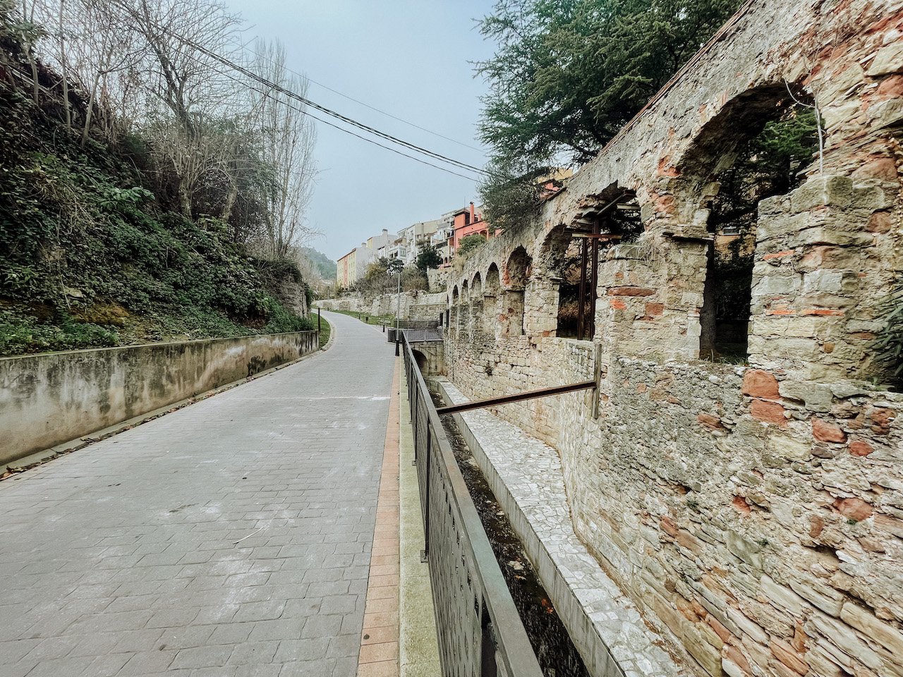
This is where it gets tricky, so these photos will help you find the start of the trail.
Walk down the hill from the train station, and through the town:
There are no signs for the hiking trail in town. Cross this bridge (I believe it’s the only one):
On the other side of the bridge, walk between these two buildings:
You’ll find yourself on this paved walkway. Follow it until it reaches a plaza, with a parking lot and businesses:
In the plaza, cross to the other side, and you’ll reach a stairway. This was the first sign for the trail we came across:
From here, it’s pretty easy. You’ll see red, white, and green painted markers which will help guide you the rest of the way up:


